Home > Europe > United Kingdom > England > Yorkshire > Well
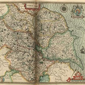
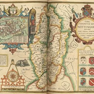
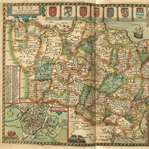
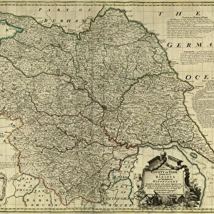
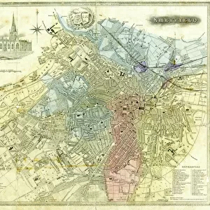
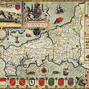
John Speeds map of the North and West Ridings of Yorkshire, 1611

![]()
Wall Art and Photo Gifts from Sheffield City Archives
John Speeds map of the North and West Ridings of Yorkshire, 1611
Image from Theatre of the Empire of Great Britaine presenting an exact geography of the Kingdomes of Ireland, Scotland, Ireland, and the Iles adioyning with The Shires, Hundreds, Cities and Shire Towns, within ye Kingdome of England, divided and described by John Speed (original at Sheffield Libraries: 914.2 SQ).
Note this image is of a genuine 400-year-old map from a tightly bound volume. It shows some wear and tear as well as the binding in the middle of the image
Sheffield City Archives and Local Studies Library has an unrivalled collection of images of Sheffield, England
Media ID 26401432
© Sheffield City Council - All Rights Reserved
FEATURES IN THESE COLLECTIONS
> Arts
> Artists
> S
> John Speed
> Europe
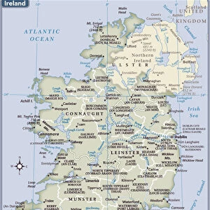
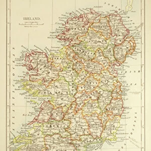
> Republic of Ireland
> Maps
> Europe
> United Kingdom
> England
> Maps
> Europe
> United Kingdom
> England
> Sheffield
> Europe
> United Kingdom
> England
> Wells
> Europe
> United Kingdom
> England
> Yorkshire
> Sheffield
> Europe
> United Kingdom
> England
> Yorkshire
> Well
> Europe
> United Kingdom
> Scotland
> Maps
> Sheffield City Archives
> Maps and Plans
> John Speed's County Maps, 1611
EDITORS COMMENTS
This print showcases John Speed's map of the North and West Ridings of Yorkshire, dating back to 1611. Extracted from his renowned work "Theatre of the Empire of Great Britaine" this image provides a glimpse into an exact geography of England during that era. Preserved within Sheffield Libraries' collection (914.2 SQ), this genuine 400-year-old map is a testament to its historical significance. Although time has left its mark on this remarkable artifact, with visible signs of wear and tear, it only adds to its allure. The binding in the middle serves as a reminder that this map was once part of a tightly bound volume, cherished by those who sought knowledge and exploration. As we delve into the details captured within this photograph, we are transported back in time to an age when cartography was both an art form and a scientific endeavor. Every line meticulously drawn by John Speed tells a story about the landscape it represents - the shires, hundreds, cities, and shire towns that shaped England's kingdom. Let us appreciate not only the craftsmanship behind this ancient map but also its ability to connect us with our past. It stands as evidence of human curiosity and ambition for understanding our surroundings. This image invites us to explore history through cartographic lenses while reminding us how far we have come in our quest for knowledge about our world.
MADE IN THE USA
Safe Shipping with 30 Day Money Back Guarantee
FREE PERSONALISATION*
We are proud to offer a range of customisation features including Personalised Captions, Color Filters and Picture Zoom Tools
SECURE PAYMENTS
We happily accept a wide range of payment options so you can pay for the things you need in the way that is most convenient for you
* Options may vary by product and licensing agreement. Zoomed Pictures can be adjusted in the Cart.